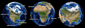
 Africa is the world's second-largest and second most-populous continent, after Asia. At about 30.2 million km² (11.7 million sq mi) including adjacent islands, it covers 6% of the Earth's total surface area and 20.4% of the total land area.[2] With a billion people (as of 2009, see table) in 61 territories, it accounts for about 14.8% of the World's human population. The continent is surrounded by the Mediterranean Sea to the north, the Suez Canal and the Red Sea to the northeast, the Indian Ocean to the southeast, and the Atlantic Ocean to the west. Not counting the disputed territory of Western Sahara, there are 53 countries, including Madagascar and various island groups, associated with the continent.
 Africa
| Area | 30,221,532 km² (11,668,598.7 sq mi) |
|---|---|
| Population | 922,011,000[1] (2005, 2nd) |
| Density | 30.51/km² (about 80/sq mi) |
| Countries | |
| Dependencies | |
| Demonym | African |
| Languages | More than 1,000 indigenous African languages including several spoken by tens of millions such as Igbo, Swahili, Hausa, Amharic, and Yoruba; Plus Arabic, English, French, Portuguese, Afrikaans, Spanish, Indian languages, others |
| Time Zones | UTC-1 (Cape Verde) to UTC+4 (Mauritius) |
Africa, particularly central eastern Africa, is widely regarded within the scientific community to be the origin of humans and the Hominidae tree (great apes), as evidenced by the discovery of the earliest hominids and their ancestors, as well as later ones that have been dated to around seven million years ago – including Sahelanthropus tchadensis, Australopithecus africanus, A. afarensis, Homo erectus, H. habilis and H. ergaster – with the earliest Homo sapiens (human) found in Ethiopia being dated to ca. 200,000 years ago.[3]
Africa straddles the equator and encompasses numerous climate areas; it is the only continent to stretch from the northern temperate to southern temperate zones.Geography
Africa is the largest of the three great southward projections from the largest landmass of the Earth. Separated from Europe by the Mediterranean Sea, it is joined to Asia at its northeast extremity by the Isthmus of Suez (transected by the Suez Canal), 163 km (101 miles) wide.[43] (Geopolitically, Egypt's Sinai Peninsula east of the Suez Canal is often considered part of Africa, as well.)[44] From the most northerly point, Ras ben Sakka in Tunisia (37°21' N), to the most southerly point, Cape Agulhas in South Africa (34°51'15" S), is a distance of approximately 8,000 km (5,000 miles);[45] from Cape Verde, 17°33'22" W, the westernmost point, to Ras Hafun in Somalia, 51°27'52" E, the most easterly projection, is a distance of approximately 7,400 km (4,600 miles).[46] The coastline is 26,000 km (16,100 miles) long, and the absence of deep indentations of the shore is illustrated by the fact that Europe, which covers only 10,400,000 km² (4,010,000 square miles) – about a third of the surface of Africa – has a coastline of 32,000 km (19,800 miles).[46]
Africa's largest country is Sudan, and its smallest country is the Seychelles, an archipelago off the east coast.[47] The smallest nation on the continental mainland is The Gambia.
According to the ancient Romans, Africa lay to the west of Egypt, while "Asia" was used to refer to Anatolia and lands to the east. A definite line was drawn between the two continents by the geographer Ptolemy (85–165 AD), indicating Alexandria along the Prime Meridian and making the isthmus of Suez and the Red Sea the boundary between Asia and Africa. As Europeans came to understand the real extent of the continent, the idea of Africa expanded with their knowledge.
Geologically, Africa includes the Arabian Peninsula; the Zagros Mountains of Iran and the Anatolian Plateau of Turkey mark where the African Plate collided with Eurasia. The Afrotropic ecozone and the Saharo-Arabian desert to its north unite the region biogeographically, and the Afro-Asiatic language family unites the north linguistically.
Climate, fauna, and flora
The climate of Africa ranges from tropical to subarctic on its highest peaks. Its northern half is primarily desert or arid, while its central and southern areas contain both savanna plains and very dense jungle (rainforest) regions. In between, there is a convergence where vegetation patterns such as sahel, and steppe dominate.
Africa boasts perhaps the world's largest combination of density and "range of freedom" of wild animal populations and diversity, with wild populations of large carnivores (such as lions, hyenas, and cheetahs) and herbivores (such as buffalo, deer, elephants, camels, and giraffes) ranging freely on primarily open non-private plains. It is also home to a variety of jungle creatures (including snakes and primates) and aquatic life (including crocodiles and amphibians)(see also: Fauna of Africa).
Territories and regions
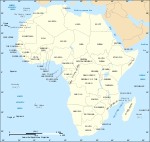
The countries in this table are categorised according to the scheme for geographic subregions used by the United Nations, and data included are per sources in cross-referenced articles. Where they differ, provisos are clearly indicated.
| Name of region[64] and territory, with flag | Area (km²) | Population (2009 est) except where noted | Density (per km²) | Capital |
|---|---|---|---|---|
| Eastern Africa: | 6,384,904 | 316,053,651 | 49.5 | |
| 27,830 | 8,988,091[65] | 322.9 | Bujumbura | |
| 2,170 | 752,438[65] | 346.7 | Moroni | |
| 23,000 | 516,055[65] | 22.4 | Djibouti | |
| 121,320 | 5,647,168[65] | 46.5 | Asmara | |
| 1,127,127 | 85,237,338[65] | 75.6 | Addis Ababa | |
| 582,650 | 39,002,772[65] | 66.0 | Nairobi | |
| 587,040 | 20,653,556[65] | 35.1 | Antananarivo | |
| 118,480 | 14,268,711[65] | 120.4 | Lilongwe | |
| 2,040 | 1,284,264[65] | 629.5 | Port Louis | |
| 374 | 223,765[65] | 489.7 | Mamoudzou | |
| 801,590 | 21,669,278[65] | 27.0 | Maputo | |
| 2,512 | 743,981(2002) | 296.2 | Saint-Denis | |
| 26,338 | 10,473,282[65] | 397.6 | Kigali | |
| 455 | 87,476[65] | 192.2 | Victoria | |
| 637,657 | 9,832,017[65] | 15.4 | Mogadishu | |
| 945,087 | 41,048,532[65] | 43.3 | Dodoma | |
| 236,040 | 32,369,558[65] | 137.1 | Kampala | |
| 752,614 | 11,862,740[65] | 15.7 | Lusaka | |
| 390,580 | 11,392,629[65] | 29.1 | Harare | |
| Middle Africa: | 6,613,253 | 121,585,754 | 18.4 | |
| 1,246,700 | 12,799,293[65] | 10.3 | Luanda | |
| 475,440 | 18,879,301[65] | 39.7 | Yaoundé | |
| 622,984 | 4,511,488[65] | 7.2 | Bangui | |
| 1,284,000 | 10,329,208[65] | 8.0 | N'Djamena | |
| 342,000 | 4,012,809[65] | 11.7 | Brazzaville | |
| 2,345,410 | 68,692,542[65] | 29.2 | Kinshasa | |
| 28,051 | 633,441[65] | 22.6 | Malabo | |
| 267,667 | 1,514,993[65] | 5.6 | Libreville | |
| 1,001 | 212,679[65] | 212.4 | São Tomé | |
| Northern Africa: | 8,533,021 | 211,087,622 | 24.7 | |
| 2,381,740 | 34,178,188[65] | 14.3 | Algiers | |
| 1,001,450 | 83,082,869[65] total, Asia 1.4m | 82.9 | Cairo | |
| 1,759,540 | 6,310,434[65] | 3.6 | Tripoli | |
| 446,550 | 34,859,364[65] | 78.0 | Rabat | |
| 2,505,810 | 41,087,825[65] | 16.4 | Khartoum | |
| 163,610 | 10,486,339[65] | 64.1 | Tunis | |
| 266,000 | 405,210[65] | 1.5 | El Aaiún | |
| Spanish and Portuguese territories in Northern Africa: | ||||
| 7,492 | 1,694,477(2001) | 226.2 | Las Palmas de Gran Canaria, Santa Cruz de Tenerife | |
| 20 | 71,505(2001) | 3,575.2 | — | |
| 797 | 245,000(2001) | 307.4 | Funchal | |
| 12 | 66,411(2001) | 5,534.2 | — | |
| Southern Africa: | 2,693,418 | 56,406,762 | 20.9 | |
| 600,370 | 1,990,876[65] | 3.3 | Gaborone | |
| 30,355 | 2,130,819[65] | 70.2 | Maseru | |
| 825,418 | 2,108,665[65] | 2.6 | Windhoek | |
| 1,219,912 | 49,052,489[65] | 40.2 | Bloemfontein, Cape Town, Pretoria[72] | |
| 17,363 | 1,123,913[65] | 64.7 | Mbabane | |
| Western Africa: | 6,144,013 | 296,186,492 | 48.2 | |
| 112,620 | 8,791,832[65] | 78.0 | Porto-Novo | |
| 274,200 | 15,746,232[65] | 57.4 | Ouagadougou | |
| 4,033 | 429,474[65] | 107.3 | Praia | |
| 322,460 | 20,617,068[65] | 63.9 | Abidjan,[73] Yamoussoukro | |
| 11,300 | 1,782,893[65] | 157.7 | Banjul | |
| 239,460 | 23,832,495[65] | 99.5 | Accra | |
| 245,857 | 10,057,975[65] | 40.9 | Conakry | |
| 36,120 | 1,533,964[65] | 42.5 | Bissau | |
| 111,370 | 3,441,790[65] | 30.9 | Monrovia | |
| 1,240,000 | 12,666,987[65] | 10.2 | Bamako | |
| 1,030,700 | 3,129,486[65] | 3.0 | Nouakchott | |
| 1,267,000 | 15,306,252[65] | 12.1 | Niamey | |
| 923,768 | 149,229,090[65] | 161.5 | Abuja | |
| 410 | 7,637[65] | 14.4 | Jamestown | |
| 196,190 | 13,711,597[65] | 69.9 | Dakar | |
| 71,740 | 6,440,053[65] | 89.9 | Freetown | |
| 56,785 | 6,019,877[65] | 106.0 | Lomé | |
| Africa Total | 30,368,609 | 1,001,320,281 | 33.0 | |


No comments:
Post a Comment